Port Access

3 Ports – 2 Waterways – 1 System
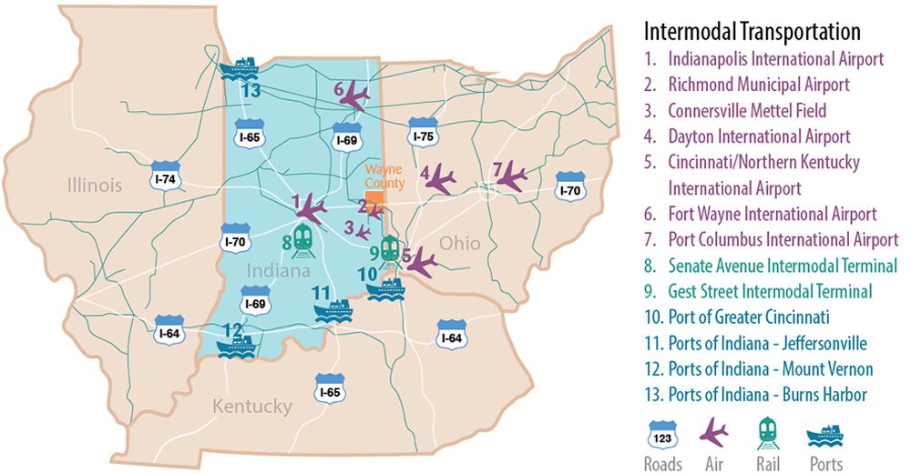
Your company’s location in Wayne County provides access to the Ports of Indiana. More than half the state’s border is water which includes 400 miles of direct access to two major freight transportation arteries: The Great Lakes/ St. Lawrence Seaway (via Lake Michigan) and the Inland Waterway System (via the Ohio River). Indiana ships about 70 million tons of cargo by water each year. Ports are located at Burns Harbor, Jeffersonville, and Mount Vernon. (Source: Indiana Logistics Directory, Ports of Indiana)
Indiana Freshwater Ports
| Port | Location | Access |
|---|---|---|
| Burns Harbor | 226 miles NW | Great Lakes, Atlantic Ocean |
| Jeffersonville | 176 miles SW | Mississippi and Ohio Rivers, Gulf of Mexico |
| Mount Vernon | 264 miles SW | Mississippi and Ohio Rivers, Gulf of Mexico |
Source: Ports of Indiana


