
Air Services
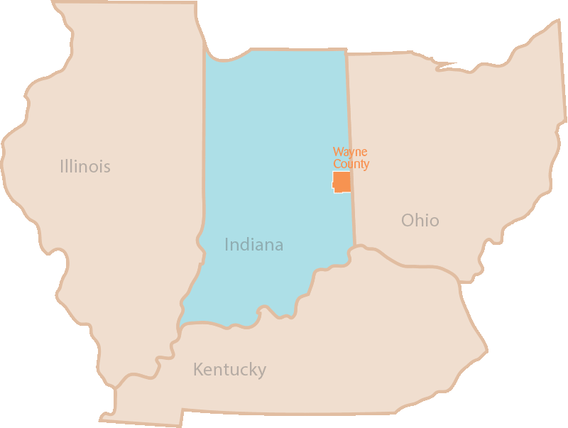

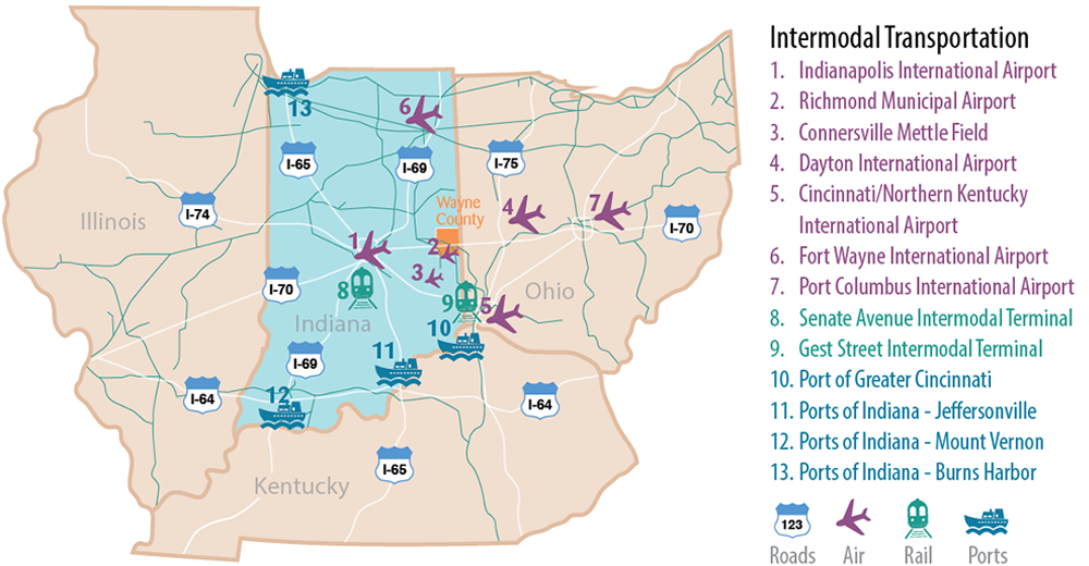
Wayne County is in close proximity to three international airports: the Dayton International Airport (DAY) and Cincinnati/Northern Kentucky International Airport (CVG) both in Ohio and the Indianapolis International Airport (IND), where the second largest FedEx Express Hub in the world is located. In addition, the Richmond Municipal Airport (RID) offers an option for business travelers who wish to fly directly into Wayne County. Lighted runways, pilot lounge, fuel, hangers, freight handling and a conference room are just some of the amenities found at the Richmond airport. The New Castle/Henry County Municipal Airport (UWL) also provides easy access for companies located in the Indiana Gateway Industrial Park near Cambridge City.
Richmond Municipal Airport (RID)
| Location | 12 miles Southeast |
|---|---|
| # of Runways | 2 |
| Runway Lengths | 5,500,’ 5,000,’ |
| Lighted Runway | Yes – Medium Intensity |
| Aircraft Storage | Hangars and Tiedowns |
| Aircraft Maintenance | Available |
Connersville Mettle Field Airport (CEV)
| Location | 23 miles Southwest |
|---|---|
| # of Runways | 2 |
| Runway Lengths | 6,503,’ 2,601′ |
| Lighted Runway | Yes |
| Aircraft Storage | Hangars and Tiedowns |
| Aircraft Maintenance | Available |
Dayton International Airport (DAY)
| Location | 45 miles East |
|---|---|
| # of Runways | 3 (2 parallel 1 Crosswind) |
| Runway Lengths | 10,900,’ 8,502,’ 7,285′ |
| Lighted Runway | Yes – High Intensity |
| Aircraft Storage | Hangars |
| Aircraft Maintenance | Airframe and Powerplant |
| Airline Carriers | 6 Major Airlines |
Indianapolis International Airport (IND)
| Location | 80 miles West |
|---|---|
| # of Runways | 3 |
| Runway Lengths | 11,200,’ 10,00,’ 7,280′ |
| Lighted Runway | Yes – High Intensity |
| Aircraft Storage | Tiedowns |
| Aircraft Maintenance | Airframe and Powerplant |
| Airline Carriers | 9 Major Airlines |
Cincinnati/Northern Kentucky International Airport (CVG)
| Location | 64 miles Southeast |
|---|---|
| # of Runways | 4 |
| Runway Lengths | 12,000,’ 11,000,’ 10,000,’ 8,000′ |
| Lighted Runway | Yes – High Intensity |
| Aircraft Storage | Hangars and Tiedowns |
| Aircraft maintenance | Airframe and Powerplant |
| Airline Carriers | 9 |
Source: AirNav